Precita Park & North Slope Bernal Micro‑Neighborhood Guide
April 2, 2026
April 2, 2026
Trying to pin down North Slope Bernal and the Precita Park pocket on a map can feel harder than expected. That is because this part of San Francisco works more like a lived-in micro-area than a neatly bounded neighborhood, with the lower north slope of Bernal Heights blending into the Mission side streets and the Precita Park corridor. If you are deciding where to buy, sell, or simply focus your home search, this guide will help you understand how the blocks relate to each other, what the housing stock looks like, and why location within this pocket matters. Let’s dive in.
North Slope Bernal and the Precita Park corridor are best understood as informal micro-neighborhood labels, not hard boundary lines. DataSF notes that San Francisco neighborhood boundaries are general-location guides, and city sources describe nearby spaces as sitting between Bernal Heights and the Mission.
A practical way to picture this area comes from the SFMTA northwest Bernal permit parking area, which is generally bounded by Mission Street, Precita Avenue, Shotwell Street, and Virginia Avenue. Within that pocket, you are really looking at a transition zone: quieter residential hill blocks, the Precita Park area, and the Mission-edge corridors closer to 24th Street.
That transition matters. SF Planning’s Calle 24 guidance explicitly describes the corridor as serving both the Mission and the north slope of Bernal Hill, which is a useful way to think about the area’s character. It is connected, but not uniform.
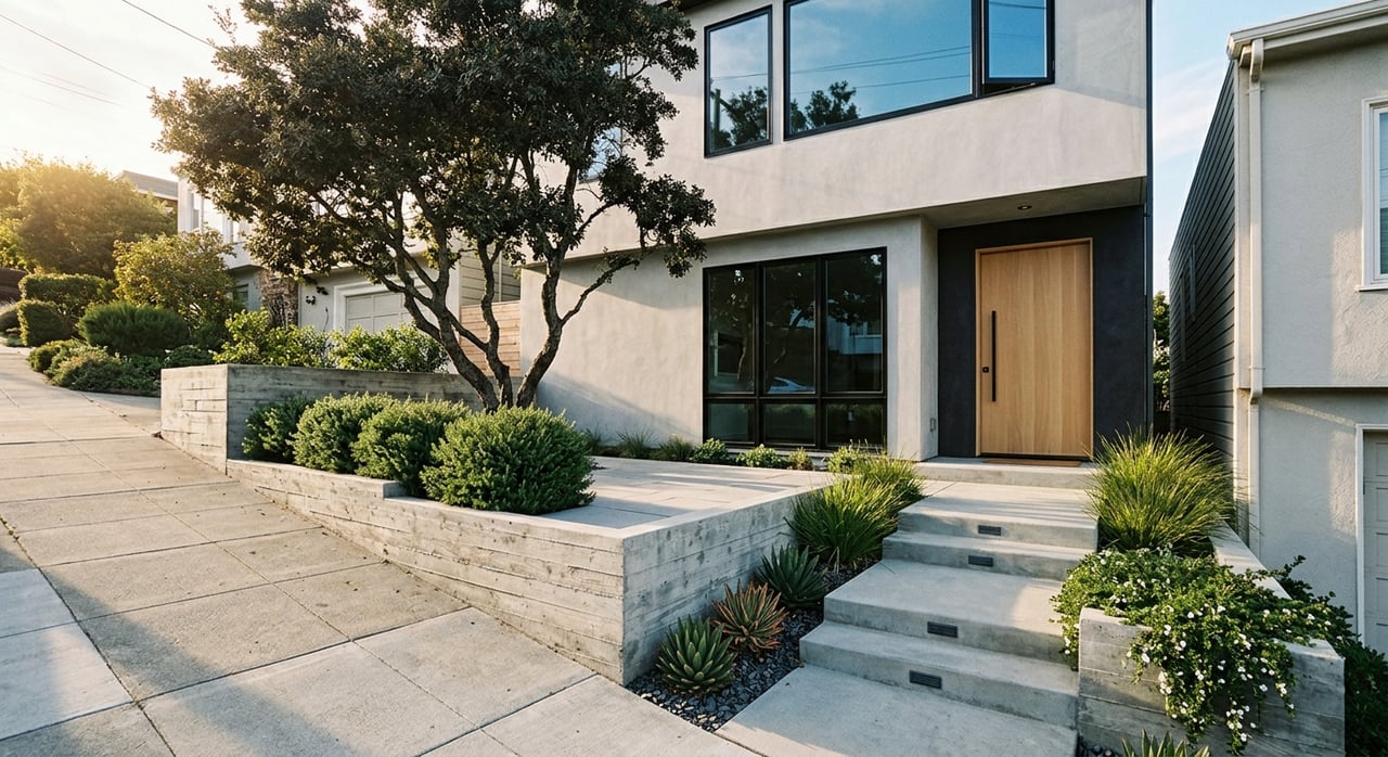
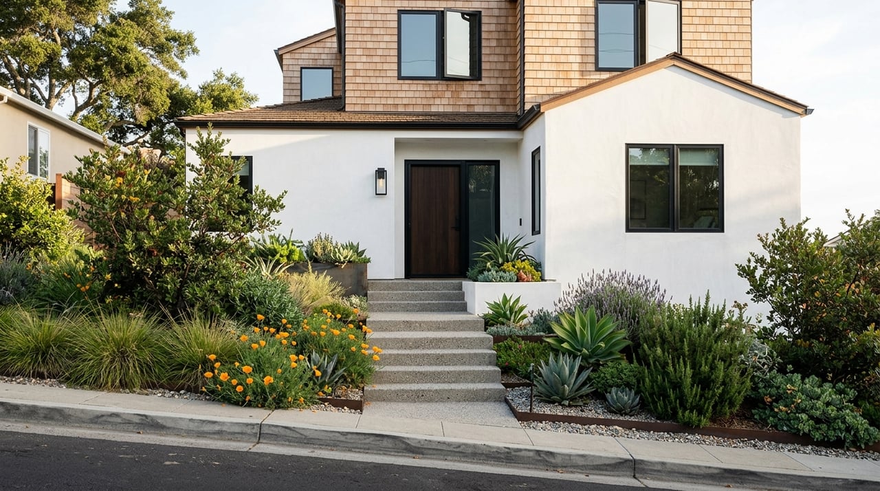
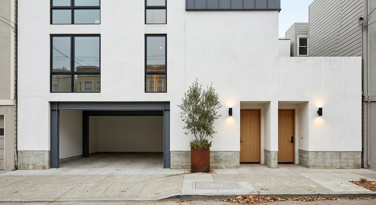
The overall built environment is mostly low-rise, historic, and residential in scale. According to SFMTA’s northwest Bernal study, these are narrow, hilly streets with many historic homes, and about half the homes in the study area had no off-street parking.
On the zoning and planning side, SF Planning’s Family Zoning Plan and Calle 24 guidance support a similar picture. Lower Bernal slopes are largely made up of smaller multi-unit parcels, while nearby buildings are often 2 to 3 stories and span styles from Victorian to Mediterranean.
The safest summary is that this micro-area is a mix of older residential housing, corner commercial buildings, and small-scale mixed-use properties. You are not looking at a place dominated by one home type or one streetscape pattern.
The upper north-slope blocks tend to feel more residential and more hillside-oriented. They can offer a stronger sense of separation from the busier commercial streets below, while still keeping you close to Bernal Heights amenities.
These blocks may also feel more exposed. The hill location can bring more sun and views, but it can also mean more wind on the upper slope and tighter parking conditions on streets where off-street parking is less common.
Around Precita Park, the feel shifts toward a neighborhood pocket with direct park access and easier movement between Bernal Heights and the Mission side. This area often appeals to buyers who want a balance between residential calm and day-to-day convenience.
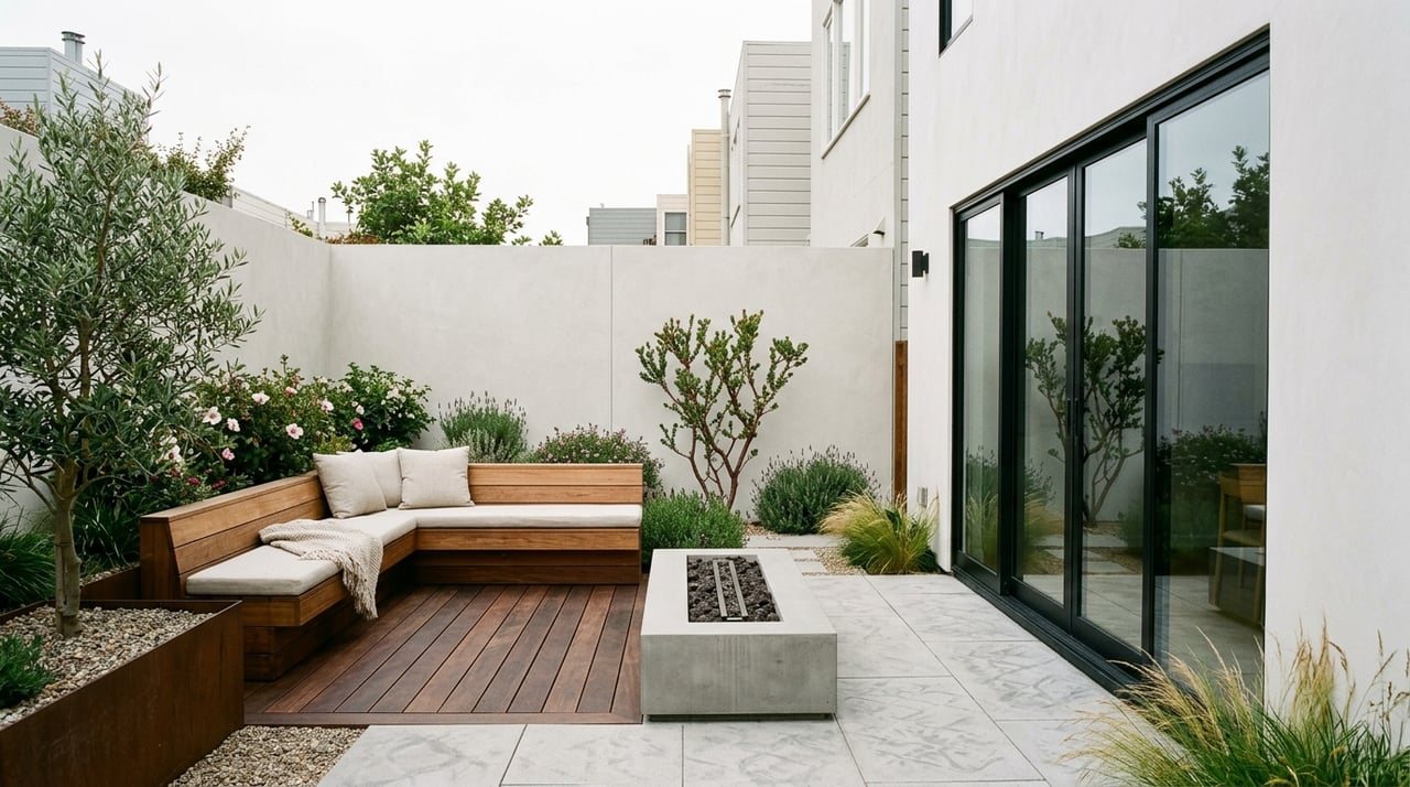
Precita Park itself is a 2.06-acre neighborhood park with a butterfly garden, gated playground, benches, a grassy field, and dog access. Nearby, Coso & Precita Mini Park adds another small patch of green in the seam between the two districts.
As you move closer to Mission Street and the 24th Street corridor, the environment becomes more mixed-use and transit-oriented. These blocks are generally the most connected for errands, bus service, and access to the broader city.
City planning documents describe both the Mission Street Neighborhood Commercial Transit District and the 24th Street-Mission corridor as active mixed-use areas with housing above storefronts and continuous retail frontage. The 24th Street area is specifically noted for Latin American restaurants, groceries, bakeries, and an active day and evening rhythm.
If this micro-area has a village center, it is Cortland Avenue. SF Planning defines the Cortland Avenue Neighborhood Commercial District as a small-scale linear shopping street with convenience goods, limited comparison shopping, mixed-use buildings, and housing above.
That is an important distinction for buyers and sellers. Cortland is not a major commercial corridor, but it does provide a small-scale neighborhood main street feel that anchors daily life for nearby blocks.
For someone house hunting, proximity to Cortland can mean easier access to everyday services without giving up the residential scale that draws many buyers to Bernal Heights in the first place. For sellers, that same proximity can help explain lifestyle appeal within the broader Bernal market.
Transit is one of the biggest factors that separates one part of this micro-area from another. SFMTA lists Bernal Heights as served by a wide network of lines, but for this guide, the most relevant routes are 67 Bernal Heights, 24 Divisadero, and 49 Van Ness/Mission.
The 67 Bernal Heights route runs daily from 6 a.m. to 10 p.m. and serves stops including Folsom/Cortland, Precita, and 24th Street Mission. The 49 Van Ness/Mission also stops at Mission and Cortland and near 24th Street Mission, while the 24 Divisadero includes Cortland and Mission in its routing.
For many buyers, the Precita and Mission edge of this area offers the strongest everyday transit convenience. Planning documents also note that the Mission Street commercial transit district is well served by BART at 16th Street and 24th Street, along with major bus service on Mission Street.
If you want easier access to transit and errands, the lower blocks closer to Mission and 24th Street may feel like the most practical fit. You are nearer to major bus lines, BART access, and mixed-use corridors that support daily routines without relying as much on a car.
If you prefer a more residential setting, the upper slope can still work well, but your day-to-day pattern may feel different. In that case, block-by-block location becomes especially important.
Open space is one of the biggest advantages of this part of Bernal Heights. You have smaller neighborhood parks close to the residential blocks, plus one of the city’s best-known hilltop open spaces nearby.
Precita Park gives this micro-area a true neighborhood green space with room to sit, play, or stop during a dog walk. It adds a sense of gathering space that can be hard to find in denser parts of the city.
Then there is Bernal Heights Park, the area’s signature open-space anchor. Rec & Park describes it as a natural area with trails, native grassland, an off-leash dog play area, and 360-degree views that include downtown, the Golden Gate Bridge, and the East Bay hills.
The climate story is also worth noting. Rec & Park places Bernal Heights in the city’s Sun Belt gardening zone, and its climate FAQ explains that neighborhood climate zones help show how sunny or foggy an environment is. In practical terms, Bernal is often sunnier than the foggier parts of San Francisco, though the more exposed upper hill can still feel windy.
If you are comparing blocks within this micro-area, a few patterns stand out.
For buyers, that means the right fit depends less on the label and more on your block-level priorities. If you care most about transit and convenience, the lower edge may stand out. If you want a quieter residential feel and stronger hill character, the upper slope may be a better match.
For sellers, the same idea applies in reverse. Positioning a home correctly means understanding whether its strongest appeal is tied to park access, village-style retail near Cortland, transit convenience near Mission, or the sunnier, more elevated Bernal setting.
In a place like Bernal Heights, broad neighborhood labels only tell part of the story. North Slope Bernal and the Precita Park corridor work best as a set of connected but distinct pockets, each with its own tradeoffs around housing type, transit, open space, parking, and day-to-day feel.
That is why local guidance matters so much here. When you are evaluating a home in this part of San Francisco, small differences in location can shape your experience more than the neighborhood name alone suggests.
If you want help sorting through Bernal Heights block by block, or you are preparing to sell and want a strategy grounded in how buyers actually read these micro-markets, connect with KJ Kohlmyer. You will get practical, neighborhood-specific guidance shaped by years of San Francisco experience.
May 28, 2026

May 21, 2026
May 14, 2026
May 7, 2026
April 23, 2026
April 16, 2026
I am a full-service real estate professional who has been buying, selling, and developing property in San Francisco for over 15 years.